Open Source
With large-scale technology transformations, business impact can be easy to spot; but genuinely positive human impact a little harder to spot. For the Humanitarian OpenStreetMap Team (HOT) impact is easy to see.
One of the few nonprofits and NGOs represented at the Open Source Summit in Bilbao this month, HOT started out as an attempt to support relief efforts in disaster-struck regions using open mapping tools – as well as to spot the gaps in preparedness, and response that could be filled using open geospatial data and tools rather than expensive proprietary software.
Now, it is a growing, international team of dedicated staffers and volunteers working across regions and concern areas; from earthquake relief in Morocco to fighting gender-based violence in Uganda. As a global community, it is mapping the places most vulnerable to disaster and poverty in order to support humanitarian aid and sustainable development across the world.
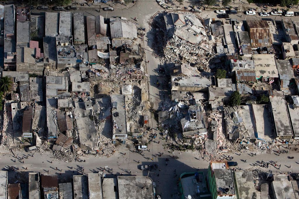
Speaking to The Stack, Petya Kangalova, an open technology advocate at HOT said: "As an organization, we would describe ourselves as a catalyst. OpenStreetMap has been around for over two decades now, but HOT started thirteen years ago in response to the earthquake in Haiti, where there was a lack of available map data for humanitarian respondents to reach communities…"
"That's when one of our flagship open source tools called the HOT tasking manager started. It's a web-based application and enables collective mapping so many people can at the same time, look at satellite images, choose a specific task and they can map [community] priorities."
The team has expanded significantly since the Haitian response, Kangalova says, both in terms of tech and geographic presence. Currently, HOT has over a hundred internationally located volunteers and staffers with a key presence in Asia Pacific, across the African continent, Latin America and the Caribbean.
So why is she at an open source conference?
"While there are a lot of tools available out there in the open geospatial world- what we focus on is enabling collective mapping" she explains: "One of the tools we have is called Open Aerial Map, which allows you to download satellite imagery into satellite inventories that are open license, which is really important…"
That has a lot of parallels with the collective approach of open source and with projects like Open Aerial Map providing a "commons" of openly licensed imagery and map layer services, these are communities with a lot in common – and while HOT perhaps seems on the surface and in essence a tech-enhanced system to organize Humanitarian efforts, developer relations are at the core of the organization.
So is a firm commitment to open source principles, elaborates Kangalova: "Our mission as an organisation is to enable communities to crowdsource open map data that they can use for decision making that they can easily access… We are trying to live the values of open source. Any tools we develop, we don't develop them alone; we build them with the communities we work with."
These efforts (you can read more about them here) are also used to upskill and engage youths from HOT focus regions. The team does this through mentorship programs. Kangalova herself has served as a mentor, she says -- emphasising the need for more DEI efforts in the sector. She also clarifies that this extends beyond just training people in technical, coding skills and also making sure that mentees have transferable soft skills.
"I personally really believe in the importance of mentorship. Something we have within the organisation is the idea of Community Working Groups, and it is not just about tech people adding or exporting tech data..."
"We have different streams for professional development and those go beyond just software skills. We also have seperate outreach programes and a lot of volunteer led intiatives that are facilitated by HOT on the ways communities are use open data."
From a field effort point of view, HOT has had quite a few impactful use cases in the recent months: "This year alone we have specific impact stories from new regions -- whether it is mapping health centers in Senegal, mapping in response like flooding in Liberia, and an interesting use case in India" – which supported fishermen in finding publicly available freshwater fishing sites.
Concluding her conversation with The Stack, Kangalova emphasises the need for more partnerships and community involvement but also the very real positive impact that open technology can have: "We are always thinking about the global aims of what we do: the resources, the impact and the contribution, and I think it is an important lens to have when it comes to tech."
You can learn more about joining the HOT community here.